The Tasman Bridge
Sun Jan 05
The bridge that brought the city of Hobart together, twice
Written by: Josh Withers
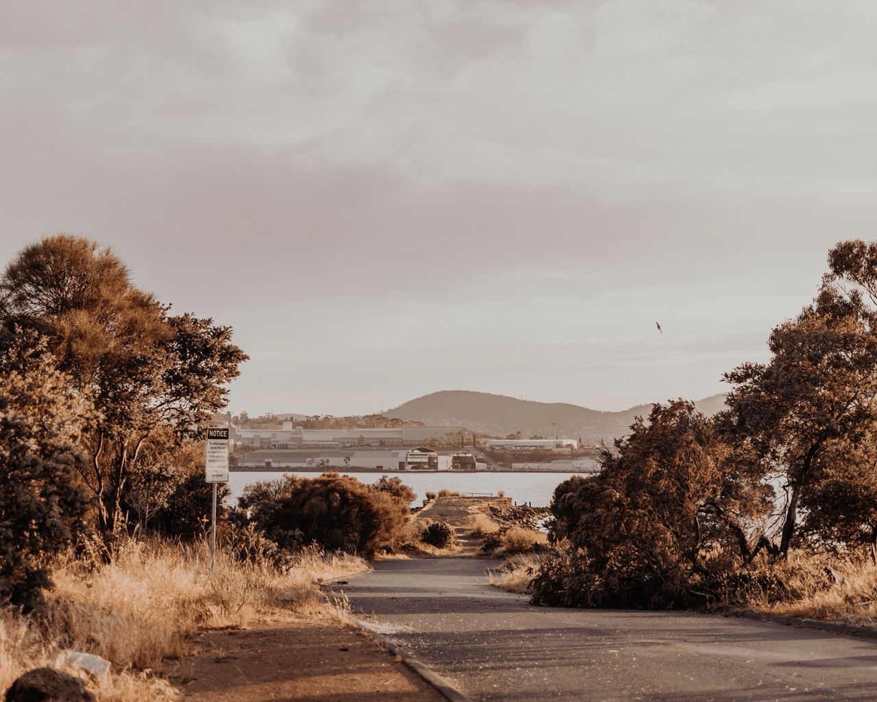
The River Derwent
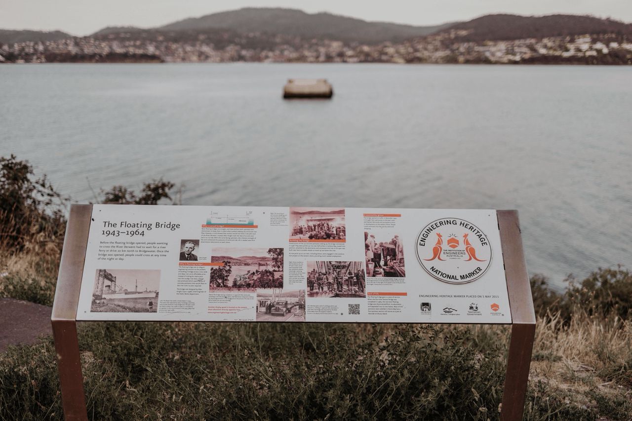
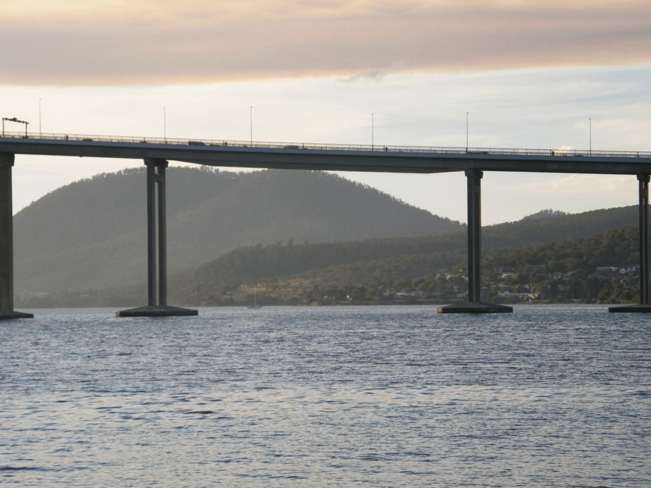
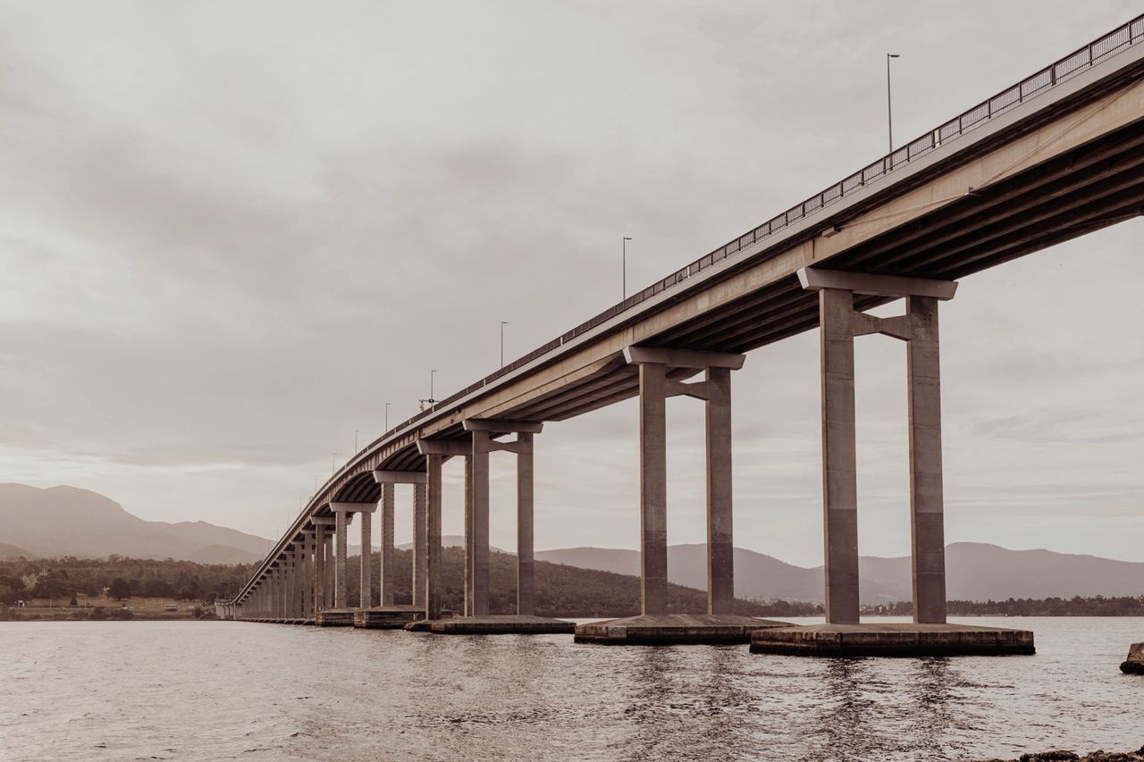
The Tasman Bridge was built across the Derwent River between 1960 and 1964 to better manage traffic and shipping. It replaced the old floating pontoon Hobart Bridge, which had been in place since 1943. Prince Henry, Duke of Gloucester, officially opened it in March 1965.
1943
- The Hobart Bridge, opened in 1943, was constructed to connect Hobart’s CBD with the growing eastern shore communities of Clarence, Sorell, and the surrounding areas. These townships were experiencing significant growth, necessitating better transport infrastructure.
- The eastern shore was developing rapidly as a residential and agricultural region.
- The construction of Hobart Airport (opened in 1956) further increased the need for efficient access between the city and the eastern suburbs.
- A floating bridge design, it was a relatively simple structure with a lift span to accommodate river traffic.
- Though innovative for its time, the bridge quickly became inadequate due to rising vehicle numbers and the growing demand for a permanent, more reliable crossing.
- The lift span caused frequent delays for road traffic, especially as the eastern suburbs expanded.
- The floating structure was not ideal for handling the increasing volume of vehicles or large river vessels, leading to calls for a more modern solution.

1960
By the 1960s, the Hobart Bridge could no longer meet the demands of the growing population and economy, prompting the construction of the permanent Tasman Bridge, which opened in 1964.

Hobart’s eastern suburbs, including Bellerive and Howrah, were rapidly expanding, and the old Hobart Bridge (a floating structure) couldn’t cope with increasing traffic demands.
Daily vehicle crossings were forecast to exceed 20,000, making a permanent solution imperative. The eastern shore was becoming a residential hub, while the western shore remained Hobart’s commercial and industrial heart. The bridge was essential to support the city’s economic growth.
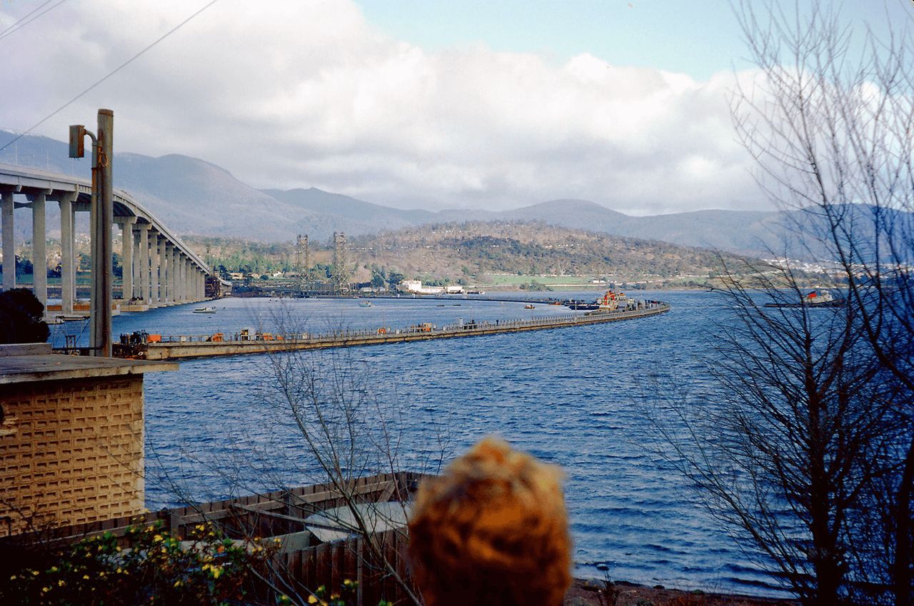
Work began on a new bridge in 1960, and the bridge opened on 18 August 1964.
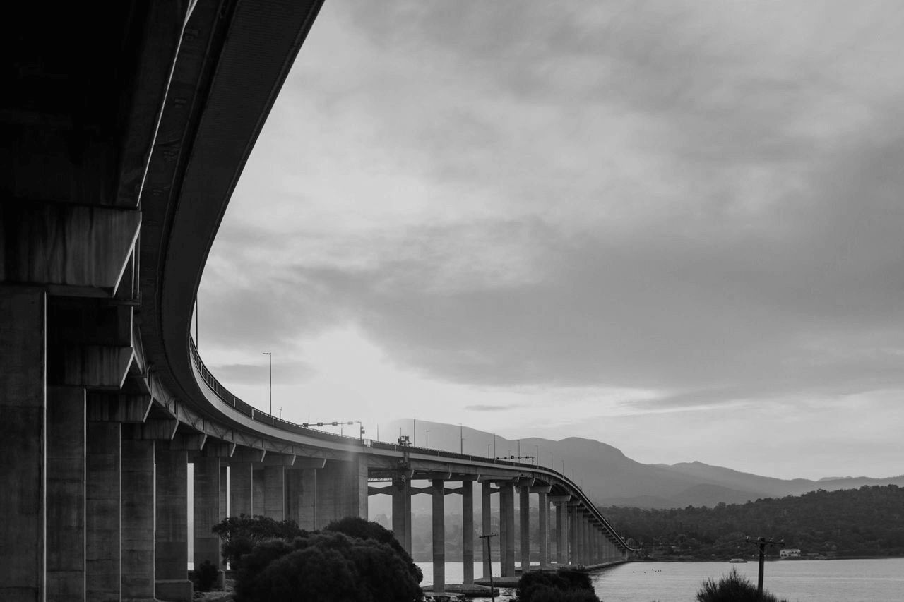
A prestressed concrete beam bridge with a total length of 1,395 metres, it featured a central navigation span for large vessels.
What is prestressed concrete? Imagine a long beam like a big building block that will hold up a bridge. If you just let it sit between two supports, it might bend or crack under the weight of cars and trucks. To make it much stronger, engineers use a method called prestressing. Before the concrete hardens, they place strong steel cables or wires inside the beam and pull them very tightly, like stretching a rubber band. Once the concrete hardens around these cables, they let go of the tension. The cables squeeze the concrete tightly, making it much stronger and able to carry heavy loads without bending or breaking. So, a prestressed concrete beam is like a reinforced block that’s been carefully prepared to be extra strong and reliable, perfect for holding up something as important as a bridge.
The new bridge was named after the first dutchman that laid eyes on the land now known as Tasman, Abel Tasman. Abel named the land Anthony Van Diemen’s Land, later renamed Van Dieman’s Land by the British, and named Tasmania on January 1, 1856.
1975
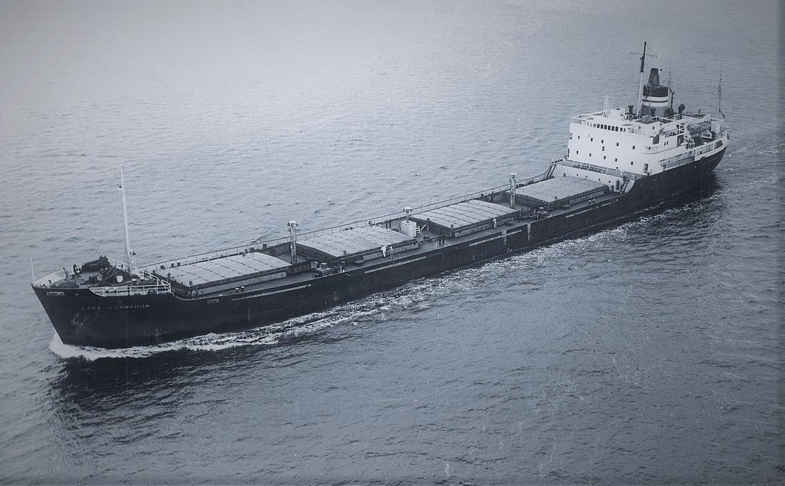
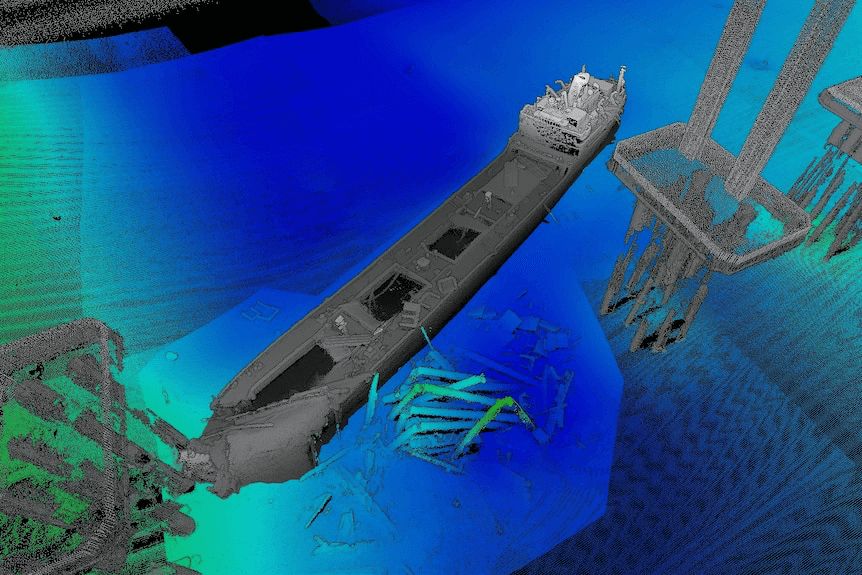
The Lake Illawarra was a bulk carrier built in 1958, 137 metres long, and carrying 10,000 tonnes of zinc concentrate from western Tasmania.
The ship had navigational issues that night on the River Derwent as it sailed towards the zinc works after sunset on the 5th of January 1975:
- Strong tidal currents in the Derwent River
- Outdated charts and equipment
- Miscommunication between the captain and crew
The Crash:
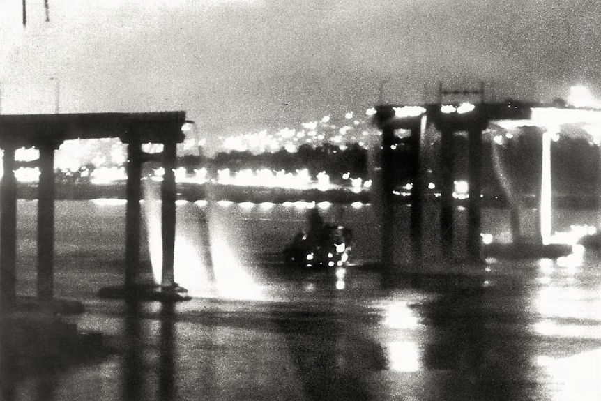
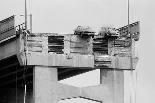
- At 9:27 pm, the bulk ore carrier Lake Illawarra struck pier 19, dislodging it and causing 127 metres of the bridge (three spans) to collapse.
- The ship listed and sank within minutes, coming to rest in 35 metres of water.
- Visibility was poor, and some argue that the ship’s captain underestimated the danger posed by the tidal flow.
- Twelve crew members drowned as the ship sank.
- Five motorists plunged into the river, and two pedestrians walking on the bridge died from the collapse.
- Keith Eccleston, a sailor aboard the Lake Illawarra, described the sinking as chaotic and terrifying, with freezing water and debris everywhere.
- Margaret Jones lost her husband when their car plunged into the Derwent. Decades later, she admitted she had never crossed the bridge again until 2025.
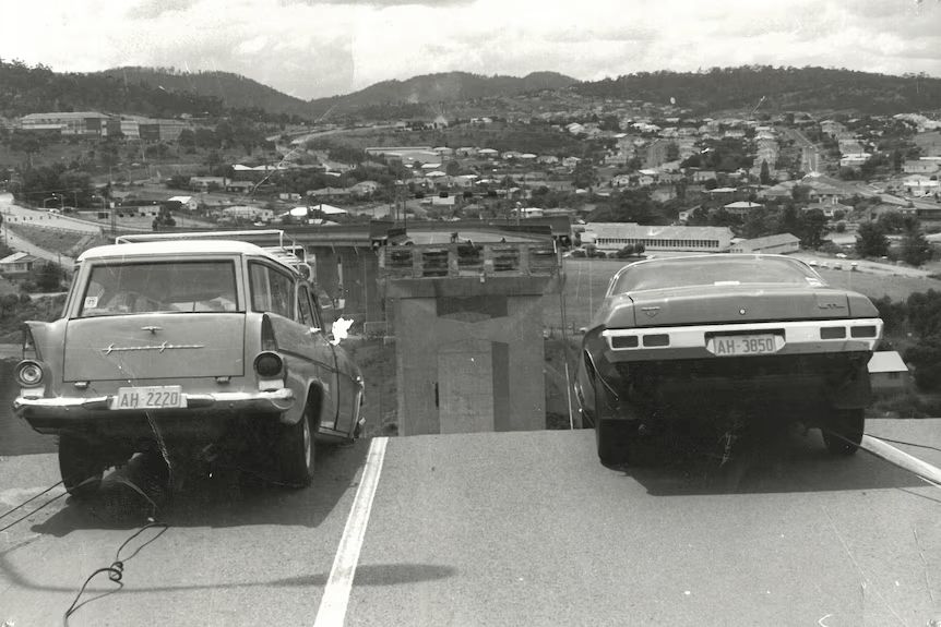
I was driving up the bridge from the Hobart side and about three-quarters of the way up, all the overhead lights went off. I thought it was a power failure and kept driving. After we got over the brow of the bridge, I saw what I thought was a car broken down on the side of the bridge. I slowed down and then all of a sudden my wife screamed out: ‘The bridge has gone!’ I hit the brakes, but it was too late and the car went over the edge. The centre of the car grounded and we just hung there. – Frank Manley1
Frank Manley credits his Monaro’s automatic transmission with saving his life. Weeks earlier when he purchased the new Holden Monaro, he wanted a manual transmission, but the salesperson sold him on a new automatic. The automatic transmission is physically larger than the manual and is what stopped his car going further.
The famous 1974 Holden Monaro is still around today, in the National Automobile Museum of Australia in Launceston, and there’s still the scratch on the roof from when he opened his driver’s door and had to swing himself up to safety.
Frank’s daughter Sharon - 16 at the time - jumped out of the rear seat and started waving down cars and buses to save them from driving off the bridge.
A City Divided
- The collapse effectively cut Hobart in two. Approximately 30% of the population (around 30,000 people) lived in the eastern suburbs and relied on the bridge daily.
- Travel time to the city centre skyrocketed. A trip that took 10 minutes by bridge became an hour-long journey using detours.
- Ferry services were reintroduced within days to restore some connectivity.
- Bailey bridges were installed upstream at Risdon, providing a temporary road crossing.
- People living on Old Beach Road reported their quiet dirt road very quickly became a highway with thousands of cars using this road to get to the upstream crossing at Bridgewater, a 90-minute trip.
- The eastern suburbs experienced a surge in local community activity as residents adapted to isolation.
- Many households purchased second cars to cope with the longer commute times, accelerating car dependency in the region.
1977
Rebuilding the Bridge:
- Engineers worked tirelessly to reconstruct the collapsed spans while ensuring the stability of the remaining bridge.
- The rebuild saw stronger piers installed.
- Navigation spans were widened to reduce the risk of future ship collisions.
- A fifth lane was added, taking the original pedestrian lane.
- The bridge reopened on 8 October 1977, after 33 months of work. It was a moment of celebration for Hobart, symbolising recovery and progress.
- The Lake Illawarra still lies at the bottom of the River Derwent today, where it crashed.
- Before the collapse, the bridge handled 22,000 vehicles daily. By the 2020s, it was accommodating over 70,000 vehicles a day.
- After the disaster, navigation aids were installed to guide ships safely under the bridge.
- A “Ship Control Centre” monitors marine traffic in the Derwent River to prevent similar incidents.

2025
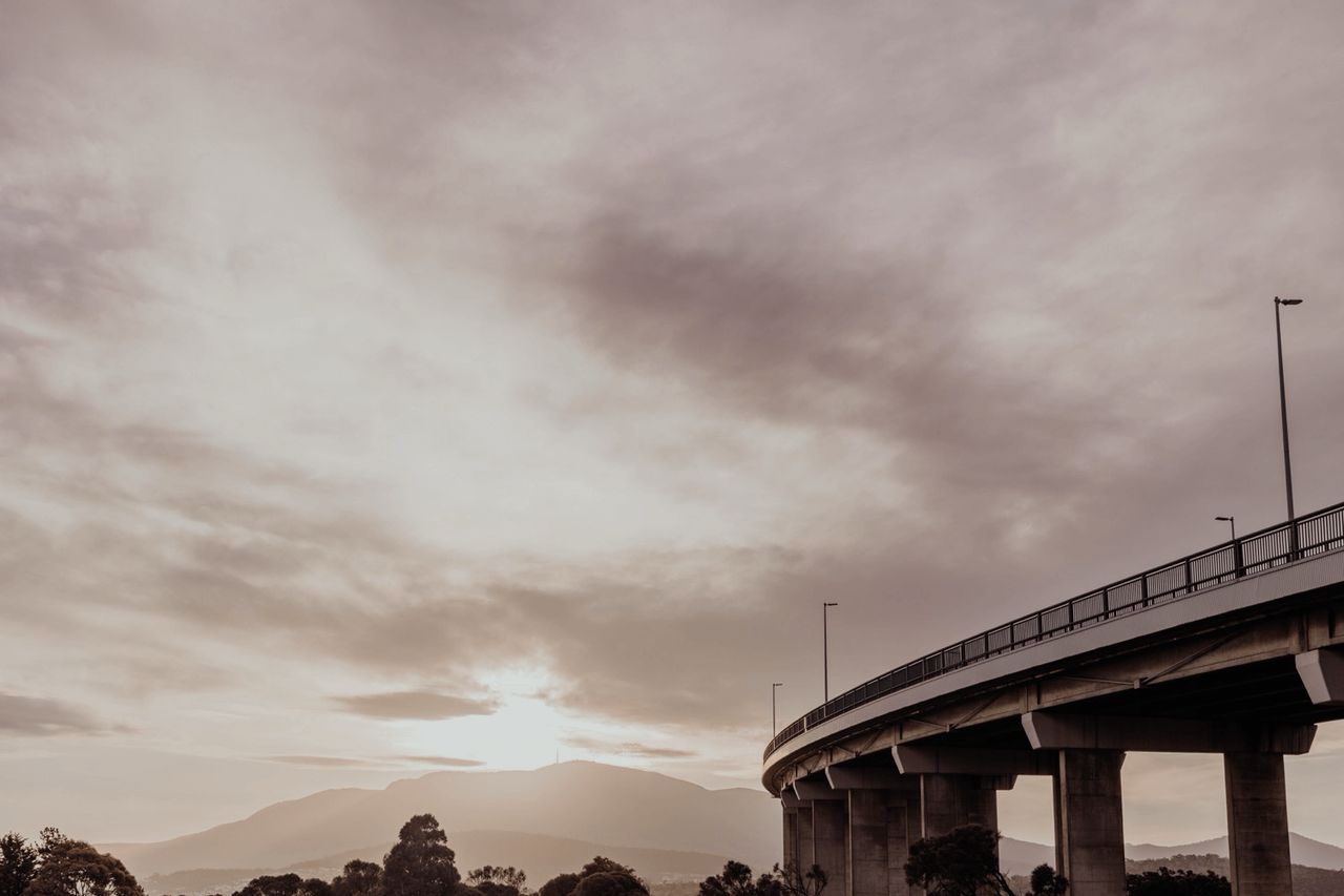
The Bridge Today:
- 100-Year Lifespan: The bridge, designed in the 1960s, was intended to last until the 2060s. With its structural lifespan approaching, questions about its future have become pressing.
- Daily traffic far exceeds what the bridge was designed to handle.
- Congestion during peak hours has become a significant issue for commuters.
- The bridge’s role in fostering car dependency has led to concerns about emissions and sustainability.
- Hobart’s eastern suburbs continue to grow, with new housing developments increasing the strain on the bridge.
- The bridge was designed with a one-hundred-year lifespan and the end-of-life deadline creeps ever closer.
- Proposals include a second bridge to alleviate congestion and a tunnel, which is a more expensive but potentially less intrusive option.
Footnotes
-
This quote is from the Hobart Mercury, 5 January 2025. ↩